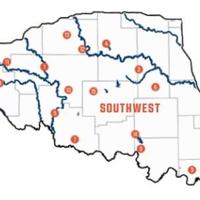
The ODWC has a new interactive dove hunting map on their website (wildlifedepartment.com) that gives updates on management areas for dove hunting. Here are a few of the top public spots for dove hunters in Southwest Oklahoma.
Ft. Cobb WMA — covers 3,500 acres in Caddo County around the north end of Ft. Cobb lake. Located south of Hwy 152 and east of Hwy 146, the area is a mixture of post oak, blackjack, red cedars and native mixed grasses. The area has uplands, flood plain and creek bottoms.
Ft. Cobb has two areas ready for dove hunters, the SE Dove field and the James Gordon plot.
Hackberry Flat WMA — covers 7,120 acres of southwestern Tillman County in Western Oklahoma. Located southeast of the town of Frederick, Hackberry Flat WMA is a combination of upland and wetland habitats.
The 3,700-acre wetland development unit consists of a variety of plants such as millet, sedges, and smartweed, and some agriculture fields. Uplands consist of agriculture fields, native grasses, improved grasses, and forbs, interspersed with mesquite, hackberry, Osage orange, black locust, and sand plum.
Managers at Hackberry suggest these three plots for hunters – Triangle, Brahnam East and Branhnam West.
There may be lots of hunters at Hackberry, but there are usually plenty of birds to go around.
Mountain Park WMA — covers 5,400 acres in Kiowa County in southwest Oklahoma. The area is on the north and west sides of Tom Steed Reservoir which is north of Snyder on Hwy 183. Mountain Park WMA is a mixture of grassland, agriculture fields and areas of scrub mesquite. The agriculture fields consist of winter wheat and milo. Wetland units are located on the northwest side of the area.
Managers suggest these areas: Smith Unit, North Side Field, and NE Dove Field.
Sandy Sanders WMA — covers 29,766 acres of Greer and Beckham counties in southwest Oklahoma. The area is located 26 miles northwest of Mangum and 26 miles southwest of Sayre. Sandy Sanders WMA is a unique area consisting of rolling to rugged terrain extending north from the Elm Fork of the Red River.
Managers suggest these areas: South Dove Field, Pick Dove Field, North Ag Field, HQ West, HQ East and HQ Terrace fields.
Washita County WMA — covers 240 acres in Washita Co. It is located approximately 3 miles northwest of Cordell, Oklahoma (From Jct. of HWY 152 and Hwy 183 in Cordell go one mile north and then go 2.5 miles west). It is a small area with a mixture of typical tall grass species and sand plum in upland areas, with cottonwood and elm in the bottomland.
Managers suggest these areas: South Dove Fields, North Dove Field.
Waurika WMA — covers 10,580 acres in Cotton and Stephens counties in southern Oklahoma and is located west of Comanche on Hwy. 53. The area mostly encompasses the floodplains of primary creeks feeding Waurika Lake and the adjacent uplands. The bottomlands are primarily American elm, hackberry, burr oak, cottonwood and willow. Uplands are vegetated by typical tall and mid grass species, with sandplum and other shrubs present. Some portions of the area are rather narrow strips of land between the lake and private land. 440 acres of wetland units are located south of Hwy 53, adjacent to Big and Little Beaver creeks, and on Walker Creek.
Managers suggest these areas: Ft. Sill Cove Dove Field, Collins Place Dove Field, and Big 4 South Dove Fields.
For maps of these area go to www.wildlifedepartment.com
Want to reach a local audience and grow your business?
Our website is the perfect platform to connect with engaged readers in your local area.
Whether you're looking for banner ads, sponsored content, or custom promotions, we can tailor a package to meet your needs.
Contact us today to learn more about advertising opportunities!
CONTACT US NOW


