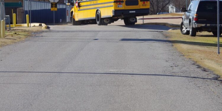
Lawton Public Schools can continue its project to install fencing around the perimeter of Lawton High, Central Middle School and Shoemaker Education Center, if the City Council makes a decision today on closing a public access point.
At issue is a request to close a dedicated public easement between Shoemaker Education Center and Central Middle School, an access point used weekdays by school buses but daily by bicycle riders crossing into Elmer Thomas Park. The Elmer Thomas Park Connector is a designated bike path that leads riders east from Greer Park/Kid’s Zone on Northwest 38th Street through neighborhoods and across North Sheridan Road and Fort Sill Boulevard to enter Elmer Thomas Park. The last leg of the trip relies on easement Lawton Public Schools granted the City of Lawton in 2013, which allows riders to cross the arterial at 753 Fort Sill Boulevard then bike through school property to link up to roads east of the school complexes.
School district wants to close easement by Central Middle School
But the school district wants to close that access point as part of its plan to install security fencing around the two school campuses and Shoemaker Education Center, a project that already has begun with installation of fence poles. Because that access is a dedicated public easement, the City Council must give permission for LPS to close it, and that cannot be done until a new bike path is identified.
The decision is more complicated than that. While city officials have been mulling over two options to replace the LPS access point — either taking the path north to Cache Road or south to Northwest Ferris — Community Services Director Charlotte Brown said the council also must designate a temporary detour until a permanent path is finished. That’s because the Elmer Thomas Park Connector is part of the city’s transportation plan, and the Oklahoma Department of Transportation said such a severe impact on an existing non-motorized transportation route means the city needs a temporary route until it completes a permanent one.
The recommendation to council is taking the temporary route south of Northwest Ferris as soon as it crosses North Sheridan Road, moving it to Northwest Dearborn Avenue and following that street through residential neighborhoods until it reaches Northwest 6th Street. Northwest 6th Street already is a designated bike route into the park.
In the meantime, the council also must decide which option it likes for the new connector: traveling north on Fort Sill Boulevard then east on Cache Road to link to the existing Fort Sill Connector; or taking the bike path to Northwest Ferris Avenue. The Streets and Bridges Committee and some council members already have rejected a staff proposal to change the four-lane segment of Northwest Ferris into three lanes between Sheridan Road and Fort Sill Boulevard, a plan that would leave enough space for designated bike lanes on the roadway.
Want to reach a local audience and grow your business?
Our website is the perfect platform to connect with engaged readers in your local area.
Whether you're looking for banner ads, sponsored content, or custom promotions, we can tailor a package to meet your needs.
Contact us today to learn more about advertising opportunities!
CONTACT US NOW


